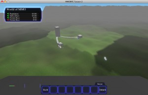
 So today I’ve managed to wire the districts I was talking about recently into the terrain generation algorithm. Right now, it’s just assigning a random brightness to each district so that you can tell them apart, and since I’m not yet doing any blending between districts (the way that I do between regions), the boundaries between districts are currently extremely sharp (and badly aliased!) I’ll tidy that up soon.
As I mentioned before, these “districts” are currently on average about 100 meters across, which means that they’d take about 20 seconds to run across, and there are about 150 of them in each region. When editing the MMO terrain, players will do it by setting terrain types and other configuration values on these districts; not by directly modifying the underlying heightmap.
Next step will be regenerating the local terrain heightmap when the player modifies a district, but the weather report for tomorrow sounds really nasty, so I’m likely to be hiding somewhere far away from heat sources like my laptop, and so will get to this stuff a little later in the week.

